Google announced Maps Imagery Grounding at Cloud Next 2026 on April 22, a tool that generates AI images anchored directly to real Google Street View scenes. Film crews, ad agencies, and visual production teams can type a text prompt and receive a photorealistic composite of any concept placed inside an actual street-level location within seconds. The resulting images integrate directly with Veo for full animated pre-visualization workflows.
What Happened
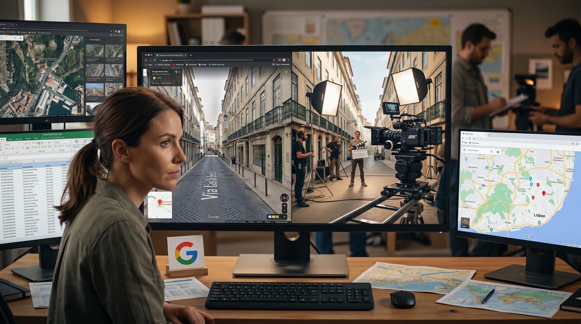
Google Maps Platform introduced three new AI capabilities at Cloud Next 2026. The most significant for creative professionals is Maps Imagery Grounding: describe a visual concept, enable grounding with Google Maps Imagery in your Gemini Enterprise Agent Platform settings, and the system fuses Google generative image models with actual Street View imagery. A prompt like "futuristic spacecraft hovering near the Washington Square Arch at dusk" returns a photorealistic composite within seconds.
Two additional capabilities were announced alongside it: Aerial and Satellite Insights for AI-powered satellite imagery analysis, and Earth AI Imagery Models added to Google Cloud Model Garden. Both are primarily infrastructure tools. Maps Imagery Grounding is the direct creator application, with Street View imagery as the grounding layer for any generative concept.
Why It Matters
Location scouting is one of the highest-cost pre-production steps in film, TV, and commercial work. Travel, location managers, and weeks of client back-and-forth consume significant budget before a camera rolls. Maps Imagery Grounding compresses that to a prompt and a few seconds of generation time.
WPP, the global advertising holding company, is already in early testing, using the tool to generate location-anchored concept visuals for luxury brand campaigns. The workflow is end-to-end: generate a grounded image against a real Street View location, iterate on the prompt, then animate with Veo for a full pre-visualization reel, all without leaving the studio.
Key Details
- Status: Private preview, US locations only at launch
- Platform: Requires Gemini Enterprise Agent Platform with Maps grounding enabled in agent settings
- Animation: Grounded images feed directly into Veo for video pre-visualization
- Early adopter: WPP is testing for luxury advertising concepting
- Apply: Google is accepting private preview applications via the official Maps Platform blog
What to Do Next
If your work involves location-based visual production, film scouting, or campaign concepting, apply for early access now. The official Google Maps Platform announcement has the application form for private preview access. US locations are supported at launch, with broader availability expected as the program scales.
The tool requires the Gemini Enterprise Agent Platform, so it is not a standalone consumer product. Teams already using Google Cloud AI infrastructure will be best positioned to integrate Maps Imagery Grounding into existing production workflows immediately. For independent creators, the private preview application is worth submitting now to get in early.